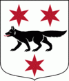
Övertorneå Municipality (Övertorneå Kommun)
 |
Until the Finnish War (1808–1809) Övertorneå and the Finnish Ylitornio were a single parish. Following the war, the eastern part of the municipality was ceded to Russia as a part of Finland. In 1870 a minor part of Övertorneå Municipality was split off, forming the rural municipality Korpilombolo (now part of Pajala Municipality). In 1969 Övertorneå and Hietaniemi municipalities were merged, forming the present municipality.
Many places in the municipality have both a Swedish and a Finnish name, in the local dialect of Finnish known as Meänkieli, one of the minority languages of Sweden.
There are four localities (or urban areas) in Övertorneå Municipality:
The municipal seat in bold
Map - Övertorneå Municipality (Övertorneå Kommun)
Map


Country - Sweden
 |
 |
| Flag of Sweden | |
Nature in Sweden is dominated by forests and many lakes, including some of the largest in Europe. Many long rivers run from the Scandes range through the landscape, primarily emptying into the northern tributaries of the Baltic Sea. It has an extensive coastline and most of the population lives near a major body of water. With the country ranging from 55°N to 69°N, the climate of Sweden is diverse due to the length of the country. The usual conditions are mild for the latitudes with a maritime south, continental centre and subarctic north. Snow cover is infrequent in the densely populated south, but reliable in higher latitudes. Furthermore, the rain shadow of the Scandes results in quite dry winters and sunny summers in much of the country.
Currency / Language
| ISO | Currency | Symbol | Significant figures |
|---|---|---|---|
| SEK | Swedish krona | kr | 2 |
| ISO | Language |
|---|---|
| FI | Finnish language |
| SE | Northern Sami |
| SV | Swedish language |